Cherrapunji Travel Guide 2026
- From Shillong 2 hrs
- Altitude 1,300 m
- Local name Sohra
- Best months Oct to Apr
Our driver stopped the car without asking whether we wanted him to. We had just crossed an old stone bridge, and the valley on the other side of it had simply opened up, wide and green and dropping away so suddenly that neither of us said anything for a moment.
I did not learn the bridge's name until my third trip to these hills, sitting out a downpour under a shopkeeper's tin roof while she told me who Duwan Singh actually was.
I have gone back to Sohra five times since that first crossing, once in the driest week of winter and once directly into the heart of the monsoon just to feel what the records actually meant on my own skin.
What follows is everything those five trips taught me, told in the order the hills actually revealed it rather than the order a checklist would put it in.
The Bridge Before Sohra
The shopkeeper poured a second cup of tea before she started talking, as if the story needed the extra warmth to come out properly. Duwan Singh, she said, was a Khasi Syiem, a chief, at the exact moment the British were pushing a new road through these hills to link the Brahmaputra valley with the plains of Sylhet.
Most of the neighbouring chiefs, led by a man named Tirot Sing of Nongkhlaw, saw exactly where that road was heading and rose up against it, fighting what history now remembers as the Anglo Khasi War. Duwan Singh chose the opposite path, staying allied with the British while his neighbour went to war over the very ground both of them stood on.
Tirot Sing lost that fight. He was captured and exiled to Dacca, where he died in 1835, still refusing to accept the road he had once tried to stop with spears and stone traps in the forest.
The road was built regardless, engineered in large part by a British officer named David Scott, and today it carries thousands of tourists a day past a bridge named for the one chief who never had to be defeated because he had already chosen not to fight.
None of that history is written on any signboard near the bridge itself. I only know it because I asked a stranger over tea, and I have not crossed that bridge since without thinking about the very different choices two Khasi chiefs made when the same colonial road reached both their doorsteps.
The town on the far side of that bridge carries its own layered naming history, and the shopkeeper had opinions about that too. The Khasi people have always called it Sohra, which British tongues flattened into Cherra, and traders later stitched on the Bengali word for a cluster of villages until the whole place became Cherrapunjee in every colonial record that followed.
She uses Sohra herself, every time, and told me the newer road signs finally do too.
Nine Months of Rain
I planned one trip specifically for July, deliberately walking into the wettest stretch of the year just to understand what the word wettest actually costs a place day to day. Within an hour of arriving the rain had stopped being weather and become something closer to a physical presence, sheets of it turning the sky the colour of wet slate and simply refusing to let go for the rest of the afternoon.
Sixteen kilometres from where I stood, the village of Mawsynram now holds the official record for highest average annual rainfall, somewhere near 11,870 millimetres a year, enough water to submerge a two storey house every twelve months. Sohra has not surrendered its own claim though, it still holds the record for the single wettest year and the single wettest month ever measured anywhere on the planet, close to 26,000 millimetres falling between August 1860 and July 1861 alone.
A retired schoolteacher I met near the old rain gauge station, a soft spoken man who had spent thirty years logging readings for the meteorological department, explained why the rivalry between the two villages is a little unfair to begin with. Sohra has kept a continuous weather station running since 1851, one of the oldest anywhere in Asia, while Mawsynram's own records stayed patchy until relatively recently, which means the comparison is really between a long, careful diary and a shorter one still catching up.
He also told me something the viewpoints never mention, that long term data from his own department shows Sohra's rainfall gently declining across the past century while Mawsynram's has held firm or crept slightly upward. Sitting on his porch, watching water sheet off the tin roof in a curtain thick enough to blur the hillside beyond it, I understood the wettest place on earth as something closer to a slow, ongoing negotiation between two neighbouring villages and a changing sky than a fixed address anyone could put on a postcard.
The Cave That Renamed Time
A guide named Banshan took me into Krem Mawmluh on my second trip, and I still remember feeling faintly embarrassed that two earlier visits to Sohra had passed without anyone mentioning this story to me. In 2018 the International Union of Geological Sciences formally carved the most recent 4,200 years of earth's history into its own named chapter, calling it the Meghalayan Age after this exact stretch of hills.
The proof sits inside this very cave, in the quiet mineral memory of a single stalagmite that had been recording the sky, drop by patient drop, for tens of thousands of years before anyone thought to read it. Buried inside its layers, scientists found the unmistakable signature of a sudden, centuries long drought that gripped the entire globe roughly four thousand two hundred years ago, severe enough to be linked to the fall of civilisations as far away as Mesopotamia and the Indus Valley.
That stalagmite now carries an official title almost nobody outside geology circles has ever heard of, a Global Boundary Stratotype Section and Point, the very first such marker ever ratified anywhere in India. Banshan led me by torchlight down a passage slick enough that I kept one hand on the wall the whole way, until we reached the exact chamber where it was found, water still falling from the ceiling the same way it has for millennia, entirely indifferent to the fact that it once helped rewrite a science textbook.
Krem Mawmluh runs more than seven kilometres into darkness, and the cave around it has since been named among the first one hundred geological heritage sites recognised on earth. Standing in that dim chamber long after Banshan had stopped talking, I felt less like a tourist and more like someone standing inside a very old, very patient clock.
Falls, Caves and a Fossilised Basket
Sohra's geography packs an unusual density of waterfalls, caves and strange rock formations into a small radius, and I have walked to each of the following at different times of year, in different weather, on different trips.
Nohkalikai Falls, and the grief behind its name
At roughly 340 metres, this is the tallest plunge waterfall in India, and its name carries one of the heaviest stories I know from anywhere in these hills. A widow named Ka Likai remarried, and her second husband, jealous of the love she gave her young daughter from her first marriage, killed the child in a fit of rage while Ka Likai was away at the market.
He cooked the child and served her to Ka Likai that evening without telling her what the meal actually was. Later, sitting at the market chewing kwai from her betel box, she found a small severed finger tucked among the leaves, and in that single instant she understood exactly what she had eaten.
She ran screaming toward the cliff and threw herself into the gorge, and the falls have carried her name ever since, Noh Ka Likai, meaning the jump of Ka Likai. I stood at the viewpoint for a long time on my first visit, the story still raw in my mind, and it turned the waterfall from a photograph into something considerably heavier to look at.
Seven Sisters Falls in the last light
Locally called Nohsngithiang, this seven segment cascade looks entirely different depending on when you arrive, and I learned that the hard way by seeing it first at flat, glaring noon. I went back on a later trip specifically for the hour before sunset, when the spray finally catches gold instead of white, and the difference was worth the second visit on its own.
Wei Sawdong, down the loose rock
Reaching this three tier waterfall means a short scramble down a slope of loose stone that keeps most of the larger tour groups away entirely. I had the pool at the base almost to myself on a quiet weekday afternoon, which Sohra does not offer often once you count the crowds at the bigger names.
Dainthlen Falls, where the serpent was cut apart
This waterfall carries one of the darkest and most detailed pieces of Khasi folklore anywhere in these hills, a story of a man eating serpent called U Thlen, the village blacksmith who finally killed it, and the blood debt that some believe still lingers in certain families to this day. I stood on the flat rock upstream where locals still point out grooves they say were left by the axes that cut the creature apart, and it is a story that deserves far more room than I can give it here.
I have told the fuller version, the parts that unsettled me most and the parts local historians now read as folk memory of an older colonial wound, in a separate piece devoted entirely to Dainthlen and the legend of U Thlen.
Mawsmai Cave, lit and walkable
This is the easiest cave in the area to visit without a specialist guide, its passages lit and its floor even enough for ordinary shoes. It made a sensible first cave for me before I attempted anything wilder on a later trip.
Arwah Cave, left in the dark
Unlike Mawsmai, Arwah is left entirely unlit, and I found myself genuinely crawling through sections of it with a headlamp and a guide close behind, palms flat against wet stone. It is a good reminder that not every cave in Meghalaya comes with a railing and a gift shop at the exit.
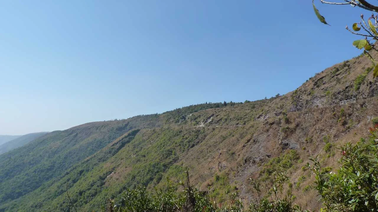
Khoh Ramhah, the giant's basket turned to stone
This rock formation rises nearly two hundred feet in a single inverted cone, and the story behind it is one I made a guide repeat twice because I liked it so much the first time. A greedy, unpopular giant once terrorised the villages around here, and the people finally decided to be rid of him by inviting him to a feast, mixing sharp iron nails into his food since iron was the one thing strong enough to end him.
He ate, and died, and the woven bamboo basket he had carried into the village that day is said to have fossilised on the spot exactly where he fell, standing there still, flanked by two smaller rocks of the same shape. Some visitors see a giant's basket in its silhouette, others see a Shivalingam, and from the viewpoint beside it you can look straight out over the plains of Bangladesh on a clear afternoon, which is its own kind of reward regardless of which shape you settle on.
Kynrem Falls inside Thangkharang Park
Tucked inside Thangkharang Park, this three tiered waterfall shares its viewpoint with a wide outlook over the plains beyond, and standing at that railing is where I first felt the actual scale of this region's rainfall machine rather than just its numbers.
A Note on the Root Bridges
No telling of these hills feels complete without the living root bridges, and I want to be honest that a single section here cannot do them justice. I made the descent to the double decker bridge near Nongriat on my fourth trip, roughly three thousand uneven stone steps down through forest that closed in green and close on both sides, thighs burning long before the steps finally opened onto a swim in the turquoise hush of Rainbow Falls pool.
Watching Khasi and War Jaintia families still tending these living structures, guiding new roots along hollowed betel nut trunks exactly the way their grandparents once did, deserves its own unhurried telling rather than a rushed paragraph squeezed between waterfalls. That fuller story, how the bridges are grown, how long they take, and how to plan the Nongriat trek properly, lives in the dedicated guide to the living root bridges of Cherrapunjee.
The Market That Moves
I arrived in Sohra once on what I assumed was an ordinary Tuesday and found the whole town nearly silent, shutters down, streets close to empty, until a homestay host explained what I had actually walked into. The Khasi week has never run on the same seven day rhythm the rest of India uses.
It traditionally follows an eight day cycle called Taïew, built around a rotation of eight historic markets across the hills, Ïewduh, Lyngka, Nongkrem, Mawlong, Rynghep, Shyllong, Pamtiah and Umni. Sohra's own big market day, called Iewbah, rotates through the calendar rather than sitting fixed on any single date, so the actual weekday it falls on shifts a little further each cycle.
I came back four days later and found the entire town transformed. Buses and shared cabs packed with people from surrounding villages lined the main road before sunrise, schools were running only half days so children could help their families sell or shop, and the whole social fabric of the region felt compressed into a single loud, fragrant afternoon.
Baskets of oranges from the surrounding hillside orchards sat beside coils of betel leaf and mounds of dried fish carried up from the plains specifically because it fetches a better price this far from any coastline. If you want to see Sohra at its most alive, do not simply show up on whichever day suits your itinerary, ask your homestay host when the next Iewbah actually falls and shape the rest of your trip around it.
Three Places I Almost Missed
Nongkhnum Island took an entire extra day to reach properly, and I nearly cut it from my itinerary the night before out of sheer tiredness. Formed where the Kynshi river splits cleanly in two, it is the second largest river island in Asia, and walking its sandy banks past paddy fields felt closer to a quiet delta somewhere in Bengal than anything I associated with Meghalaya's cliffs and caves.
Two waterfalls, Weinia and Langshiang, sit at either end of the island, and I spent an entire unhurried afternoon moving between the two, stopping to watch a family harvest rice in a field that ran right up to the water's edge. Almost nobody I met elsewhere in Sohra had actually been there themselves, despite most of them knowing exactly where it was.
Lum Diengiei, the third highest peak in Meghalaya, took a different kind of effort, a moderate climb through thinning forest that left my legs sore for two days afterward. Khasi tradition counts this hill among the three sacred peaks of the whole plateau, alongside Lum Shyllong and Lum Sohpetbneng near Shillong, and standing at the top with a clear view stretching all the way to the Brahmaputra plains, I understood why a mountain earns that kind of reverence rather than simply a name on a map.
Wahkaba Falls I only found because a homestay host drew me a rough map on the back of a receipt, insisting I would regret leaving Sohra without seeing it. The trek in ran through dense greenery thick enough to blot out most of the sky, and when the falls finally appeared through the trees I had the entire clearing to myself for nearly half an hour before another traveller wandered in.
Sohra also carries a quieter industrial history that has nothing to do with waterfalls at all. For decades the town hummed with limestone quarries and cement kilns, an identity almost nobody associates with it today, now fading fast as concern for the fragile cave systems beneath these hills has slowed the digging considerably.
Small orchards of Sohra oranges still dot the slopes around town, the very fruit that once helped shape the region's old trading reputation, sold from roadside stalls by growers whose families were farming this soil long before a single postcard existed. If you want to walk a piece of the region's colonial history rather than just read about it, the David Scott Trail threads through these same hills, stitched together from routes the road building officer once helped carve, still walked today by trekkers who often have no idea whose footsteps they are retracing.
Things I Learned the Hard Way
I found out on an early trip that Indian citizens need no inner line permit to enter Meghalaya, though foreign travellers should still confirm current Protected Area Permit rules for certain border stretches before booking anything. I ran short on cash more than once outside the main town, since card machines thin out fast once you leave it, and I now carry more than I think I will possibly need every single time.
My phone lost signal almost entirely on the descent toward Nongriat, and I have learned since to download offline maps the night before rather than trust a connection that simply is not there. I also packed only a single umbrella on my first trip and watched it turn inside out within minutes, since a proper poncho and sealed dry bags for electronics are the only things that actually hold up against rain that arrives sideways here.
A quiet trick worth repeating, ask about Iewbah before you finalise your dates, since timing a visit around market day will show you a version of Sohra that a fixed weekend itinerary simply cannot.
For the Curious
Sohra sits close to 1,300 metres above sea level, noticeably lower than Shillong despite feeling wetter and wilder underfoot.
The Khasi traditional week, Taïew, runs eight days rather than seven, a rhythm still followed for market days even as the Christian calendar's Sunday has reshaped parts of it.
Krem Liat Prah, part of the same cave network as Krem Mawmluh, is counted among the longest cave systems anywhere in the Indian subcontinent.
David Scott, the British officer whose road building set off the very war Duwan Singh sat out, has both a memorial and a trekking trail named after him in these hills.
Sohra's limestone and cement industry once rivalled its rainfall as the thing the town was best known for regionally.
The word khublei, meaning thank you in Khasi, works just as well in Sohra as it does in Shillong.
On my last morning in Sohra the rain had eased into the kind of soft grey drizzle that barely registers as weather here anymore. I sat outside the homestay with a cup of tea, watching mist move through the valley the way it had every single morning I had stayed, entirely unbothered by how many records had ever been written about it.
What I carried home was not the rainfall statistics, impressive as they genuinely are. It was the quiet weight of a bridge named after a choice, a cave that once rewrote a page of the planet's own calendar, a giant's basket turned to stone, and a market day that refuses to sit still on any single date the way the rest of the world expects a Tuesday to behave.
Sohra does not perform for the numbers written about it. It simply keeps recording the sky exactly as it always has, and if you give it enough mornings and enough nights, it hands you a story for nearly everything you walk past.
first of all. thanks for the comment on my blog. secondly very amazing post... and thirdly the blog design is fantastic.
I love travelling and to be honest cherrapunji is one of those places i would love to visit within the next couple of years. very nice photos...
:D
guess what i was born in Shillong and spent 20 years of my life in Shillong .. my fav place in the whole world. Cheerapunji is one such place we used to visit so often. You have captured beautiful photos. nice post.
wow... what a place...
superb snaps. as u said, it needs patience 2 cover such beautiful nature...
hi,
Well inspired by your website... i have spent an entire day bugging myself over how to make a menu bar... that looks great... :D thanks for the inspiration
Gorgeous framing!
beautiful colors...lovely image!
Lovely, I so want to see this heaven! Very very beautiful and serene :)
Cheers,
Only heard of place ...about the rains,....never been there..would like to go there
Very picturesque! It's fabulous vacay destination in the future :)
Thanks for stopping by my blog and for your generous comment... Your blog is very remarkable, both in its presentation and content.All the best... :)
bright and colurfully beautiful!!
Lovely shots! Its such a beautiful place...I visited when I was a kid...I have faint memories of the place!
PS: Thanks for visiting my blog and leaving a note. Hope to see you again.
Nice photo, I like these flowers.
Hey Kalyan!!!! Thanks for stopping by homeShanthihome. And you have the honor of being the first male member who commented on any of my posts. I will remember that and your photo in this post is gorgeous. That is one part of India I never ventured into. Hopefully one day soon I will land there :-). Thanks again.
oh, what a beautiful land! I' fascinated by the Living Root bridge and how it's made. that is amazing. thought I think I would be hesitant to walk it! thanks for stopping by my blog and saying hello, I truly appreciate it. happy day to you.
♥♫♪
°º✿
º° ✿✿♥ Olá!
A foto é maravilhosa... um lugar com uma vegetação dessas... montanhas como essas... é simplesmente exuberante.
Bom fim de semana!
Beijinhos.
Brasil
♥♫♪
°º✿
°º✿✿♪♫° ·.
Beautiful capture!
Nice DOF!
Thanks for your visit this week. :)
What an incredibly beautiful place! Love the colorful flowers and what a breathtaking capture! Hope you have a wonderful day! Thank you for your visit to my blog and your kind words!
Sylvia
Lovely photo on the mountain range and landscape!
Thank you for your visit to my blog too:)
Kay Ellen
Gorgeous!
Your photography is brilliant! This photo is so beautiful... I thought it must be in Hawaii and then I see you are in India. I did not know that it is so gorgeous there. Thank you for visiting my blog.
Nicely done. It must have been amazing to be there.
THat's a gorgeous shot!
Happy day
What a beaytiful photo. Thank you for your visit.
A wonderful photo with a beautiful view over the mountains and the waterfall.
Great colors !
Lovely landscape.
So beautiful and colorful blog, reminds me of spicy India.
Grazie!
Have a wonderful Sunday
greetings from Italy
Matteo
Beautiful capture, i like it!
Until reading this wonderful post and being immersed in your outstanding pictures, I had no idea of the existence of this remarkable place! Thank you so very much for sharing it!
Thanks for dropping by my blog. You had a very nice blog and very beautiful picture.
Loveley photo and thank you for visiting my blog.
Thanks for visiting my blog. This place is wonderful!!!!Thank you for sharing with us the beauties of your country.
I like also the graphics of your blog.
Ciao from Italy.
Erika
Beautiful landscape.
This is a beautiful portrait of the area. The colorful plants makes it all the more interesting.
Beautiful. Never been to NE India, its always on my wish list. Thanks for sharing the picture with us.
Looks like a gorgeous place!! Love all the waterfalls... and the colors of the flowers! =)
It sounds like a magical place.
very beautiful
And Rhododendrons - my favourite flower.
thank YOU for visiting me this morning and for sending such beauty my way via this fabulous VIEW! Ahhhhh.....what a place...I may never see, but thanks to Blogging, we can visit one another. Have a peaceful day, Anita
Beautiful photo. Thanks for visiting my blog. I appreciate your nice comment.
Please visit again.
Beautiful view!
The sound of rain is joyful! Lovely shot.
Beautiful scenery - great composition!
beautiful photo. lovely bright colors against that lovely backdrop.
The vivd colors of the close greenery makes a fine setting for showing us these cloud covered mountains in the distance. Well done.
Now, that does sound and look like Heaven.
Thanks for your visit and nice comments.
Beautiful photo and thanks also for your comment.
Incredibly beautiful and picturesque photographs of a very lovely piece of geography. That's a lot of rainfall. huh?